Also published in Shapeways Magazine
—–
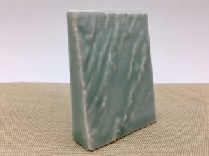
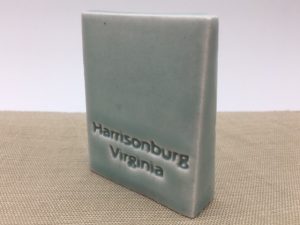
Sometimes you just want a little piece of Earth to call your own. For example, here’s a Porcelain Ceramic relief map of the Shenandoah Valley region around Harrisonburg, Virginia:
But where do you get the map data? There is a lot of it online, but not all of it is suitable for 3D printing or easy to export.
Here’s where Terrain2STL comes to the rescue. Terrain2STL is a website specifically devoted to “Creating STL models of the surface of Earth.” You can navigate a world map, zoom in anywhere, and export a rectangular terrain region that can be 3D printed on its own or mixed into other designs.
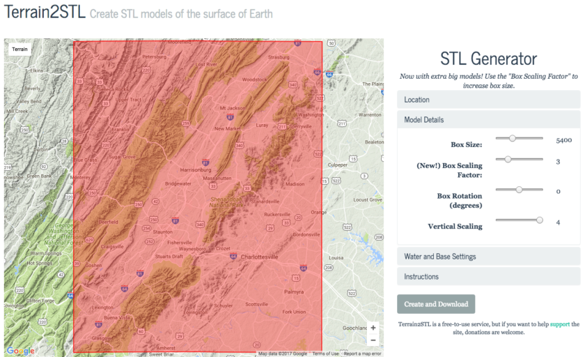
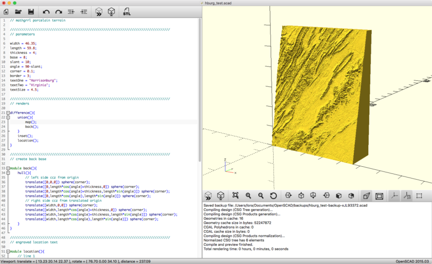
Using Terrain2STL
Terrain2STL is easy to use. Just find your region, choose a box size, and decide whether or not you want to exaggerate the land and water features (you probably do). Here’s the region we exported for the design pictured above. Note that we maxed out Vertical Scaling so that the mountains would be more pronounced.

After you’ve exported a map from Terrain2STL, you can add it to any 3D design, however you like.
An OpenSCAD Stand For Your Map
If you want to make a Porcelain Ceramic keepsake map like ours, you can use our Topo Map Stand Customizer on Thingiverse to create a labeled base for your terrain map. To optimize for printing in Porcelain Ceramic, the base of the Topo Map Stand has an inset; only a ring around the base will remain unglazed.
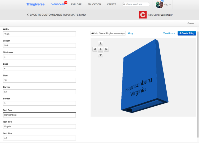
If you prefer working in OpenSCAD, download the code from the Customizer. (For help getting started with OpenSCAD, check out our previous Tutorial Tuesday about Using OpenSCAD to Design With Code.) You can also import your map STL file into OpenSCAD so you can see how it sizes up with the stand.
Here’s how the labeled back of our model came out after glazing in Gloss Celadon Green:
Tips for Porcelain Ceramic Models
Although Porcelain Ceramic does not preserve small map details, prominent mountains and water features look great when glazed. Some areas appear lighter or darker, depending on how much glaze collects in each area. To learn more about how Shapeways makes its Porcelain Ceramic models, from printing and molding to glazing, firing, and post-processing, check out the article Announcing a New Evolution for Porcelain.
For even more information, see the helpful Shapeways articles Tips for Designing in Porcelain and Tips for Getting the Most Out of Details in Glazed Porcelain.
Do you have other suggestions for easily extracting world map data for 3D printing? Or other uses for maps in your 3D models? Let us know in the comments; we’d love to feature your work in a future Tutorial Tuesday post!
——————
As an Amazon Associate we earn from qualifying purchases, so if you’ve got something you need to pick up anyway, going to Amazon through this link will help us keep Hacktastic running. Thanks! :)
Leave a Reply